Most Fiji holidays start here, whether travellers realise it or not. Nadi International Airport, the main gateway for nearly everyone arriving in Fiji, sits on Viti Levu, and so does Suva, the capital, along with the bulk of the country’s population, roads, and everyday life. Yet a lot of visitors fly in, transfer straight to a resort or a boat to the outer islands, and never really register that they’ve spent their whole trip on one specific island with its own distinct geography and character.
This piece is about getting to know Viti Levu itself: how it’s shaped, what its different regions offer, and why it’s worth treating as more than just a layover between the airport and somewhere else.
Where Viti Levu Sits and How Big It Is
Viti Levu is the largest island in Fiji, covering roughly 10,400 square kilometres, which works out to a little over half of the country’s total land area. Despite Fiji’s reputation as a scattered archipelago of 300-plus islands, Viti Levu alone is home to around 70% of the national population, making it by far the most developed and populous part of the country. The island measures roughly 146 kilometres long and 106 kilometres wide, with a mountainous interior that shapes almost everything about how people live, farm, and travel here.
A Mountain Range That Splits the Island in Two
The single most defining feature of Viti Levu is its central mountain range, which runs through the island and creates two distinctly different climate zones on either side. Tomanivi, Fiji’s highest peak at 1,324 metres, anchors this range and separates a wetter, greener southeastern half from a drier, sunnier northwestern half.
The southeastern side, where Suva sits, receives significantly higher rainfall, which is exactly what produces the lush rainforest, rivers, and waterfalls the region is known for. The northwestern side, home to Nadi and most of the country’s beach resorts, is noticeably drier and sunnier for much of the year, a big part of why the west coast became Fiji’s main resort belt in the first place. Understanding this split is genuinely useful when planning a trip, since it affects everything from which region suits your travel dates to how much rain you should realistically expect.
Nadi: The Arrival Point and Resort Hub
Nadi, on the drier western coast, is where almost every international visitor to Fiji lands, and it functions as the country’s tourism hub by default. The town itself is fairly modest, but the surrounding area includes Denarau Island, Fiji’s main resort strip and the departure point for boats to the Mamanuca and Yasawa Islands. Nadi’s dry, sunny climate for most of the year, combined with its proximity to the airport, makes it the natural first and last stop for most Fiji itineraries.
Suva: The Capital on the Wetter Coast
On the opposite side of the island, Suva is Fiji’s capital and largest city, sitting on the southeastern coast where the wetter climate produces a noticeably greener, more tropical feel than Nadi. Suva functions as the country’s administrative and commercial centre rather than a resort town, with a genuine working city atmosphere, markets, museums, and a university, alongside easy access to some of Viti Levu’s best rainforest and river day trips.
The Coral Coast: Fiji’s Classic Beach Stretch
Running along the southern coast between Nadi and Suva, the Coral Coast is one of Fiji’s original tourist areas and remains a popular alternative to Denarau, generally at a more accessible price point. It’s a tidal coastline, so swimming conditions shift noticeably between high and low tide, and the region is well known for its resorts, golf courses, and access to attractions like the Sigatoka Sand Dunes and Kula Eco Park.
Rakiraki and the Northern Coast
Less visited than the west or south, the northern stretch of Viti Levu around Rakiraki tends to attract travellers looking for a quieter, less developed pace, along with strong diving access to the Bligh Waters. It’s a useful example of how much variety exists on a single island once you move beyond the two or three areas most itineraries default to.
The Interior: Rainforest, Rivers, and Highland Villages
Viti Levu’s mountainous interior is genuinely under-visited relative to what it offers. The Namosi Highlands, accessible from the southern coast near Pacific Harbour, combine river trips, waterfalls, and traditional village visits in a setting that feels far removed from the coastal resort experience. Rivers like the Navua and Sigatoka cut through this interior, carrying rich sediment down to the fertile valleys where much of Fiji’s sugarcane, rice, and other agriculture is grown.
What There Is to Do on Viti Levu
Given its size and geographic variety, Viti Levu covers a wider range of activities than most visitors expect from a single island.
- Beach and resort time along Denarau, the Coral Coast, and smaller resort pockets elsewhere on the coastline.
- Rainforest walking and swimming at spots like Colo-i-Suva Forest Park near Suva, where clear freshwater pools sit within an easy walk of the city.
- River adventures, from gentle village-based longboat trips on the Navua River to whitewater rafting further upstream in the highlands.
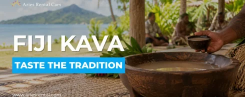
- Cultural experiences, including village visits, kava ceremonies, and markets in both Nadi and Suva, each offering a genuinely different flavour of Fijian daily life.
- Diving and snorkelling, particularly around Beqa Lagoon in the south and the Bligh Waters off the northern coast, both known among divers for their reef systems.
- Golf, hiking, and inland exploration, especially around the Coral Coast and the Nausori Highlands, for travellers who want more than beach time built into their trip.
If a full day out sounds appealing, some of the best day trips from Suva give a practical sense of how to structure time around the capital, while the wider range of things to do on the Coral Coast covers the western half of the southern coastline in more depth.
Getting Around Viti Levu
Two main sealed roads circle the island: the Queens Road along the southern coast connecting Nadi, the Coral Coast, and Suva, and the Kings Road running along the northern coast through Rakiraki. A full loop of the island is possible in a single long day by car, though most visitors find it more comfortable spread across two or three days with stops along the way. Self-driving is one of the more flexible ways to see Viti Levu’s variety firsthand, since public buses, while functional on the main routes, don’t easily reach some of the interior villages, waterfalls, and quieter beaches that make the island worth exploring beyond its resort strips.
Why Viti Levu Deserves More Than a Transit Stop
It’s easy to see Viti Levu purely as the place you land before heading to the “real” Fiji out on the smaller islands, but that framing undersells what’s actually here. The climate split alone means Viti Levu effectively offers two different versions of a tropical holiday depending on which coast you choose, and its interior holds some of the most genuinely undertouristed scenery in the country. For travellers with even a few extra days built into their itinerary, spending real time on Viti Levu itself, beyond the airport transfer, tends to add a dimension to a Fiji trip that island-hopping alone doesn’t cover.
Conclusion
Viti Levu is Fiji in miniature: dry western beaches, a wet, green capital region, a mountainous interior, and enough variety in between to fill a full trip without ever needing a boat. Whether your priority is resort time on Denarau, a cultural stop in Suva, or a river trip into the highlands, understanding how the island’s geography shapes each region makes it much easier to plan a trip that actually matches what you’re looking for.
Frequently Asked Questions
Yes, Viti Levu is Fiji’s largest island, covering just over half the country’s total land area and home to around 70% of its population, including the capital, Suva, and the main international airport at Nadi.
Viti Levu covers roughly 10,400 square kilometres, measuring about 146 kilometres long and 106 kilometres wide.
Nadi, on the western coast, is drier, sunnier, and functions as Fiji’s main tourism hub near the international airport. Suva, on the southeastern coast, is the capital and a wetter, greener working city with a different, more local atmosphere.
A full loop via the Queens Road and Kings Road is possible in a single long day, though spreading it across two or three days allows time to actually stop at attractions along the way rather than just driving through.
Highlights include beach time on the Coral Coast or Denarau, rainforest walks at Colo-i-Suva, river trips into the Namosi Highlands, diving around Beqa Lagoon or the Bligh Waters, and cultural experiences like village visits and local markets in Nadi and Suva.
Nearly all international visitors arrive at Nadi International Airport on Viti Levu, even if their final destination is an outer island reached by boat or seaplane from there. A smaller number arrive via Nausori International Airport near Suva.